Excursions to the Islands
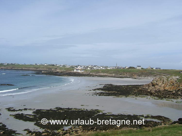
Ile de Ouessant
An old seafarer expression: “qui voit Ouessant, voit son sang” which translates to: Whoever sees Ouessant, sees his own blood… in other words, his own end approaching.
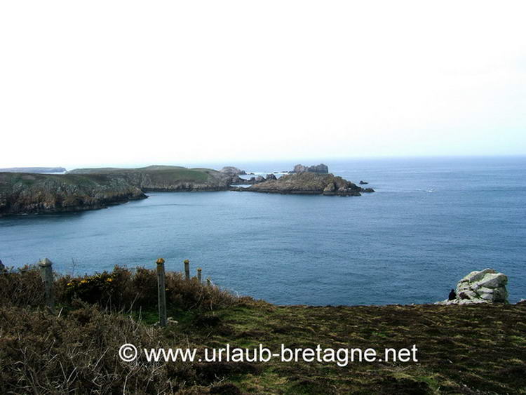
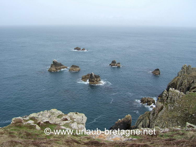
The Île d'Ouessant is the most remote and wildest of the French Atlantic islands, she is surrounded by treacherous sea trenches. Ships attempting to approach from the east have to negotiate the notorious five metre deep “Passage du Fromveur”in which Europe’s most powerful tidal currents whip up the water.
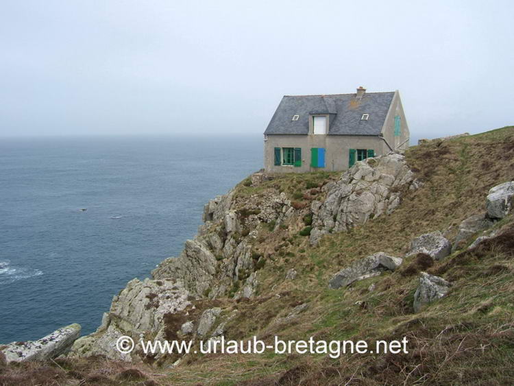
In the midst of the turbulent Atlantic, the eight by four kilometre island, named “Enez Eusa” in Breton, gives the impression of a massive granite fortification lying at anchor in depths of the sea. The turquoise coloured bays, the yellow gorse, the heathers, ferns and the soft grass on which the locally celebrated black sheep graze, remind one of the famous Emerald Isle - Ireland. Of the very few trees that grow here, most are small, bent and twisted, victims of the gale force winds that rage here. Although the vegetation is quite meagre, it offers cover and protection for a vast number of seabirds.
The main town is Lapaul. There are a few bars to be found in the small, winding alleys surrounding the church.
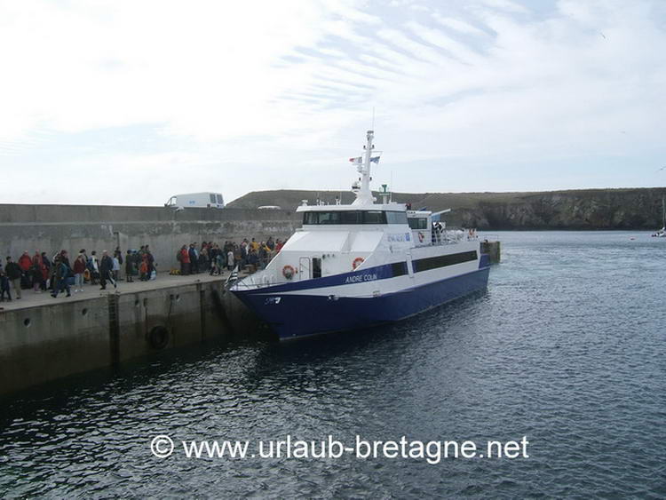
Ferry transit to the Ilands.
The island’s various dwellings lie scattered far and wide. Numerous small gardens, decorated with buoys and all sorts of boating paraphernalia are home to hortensias and other typical coastal flora.
Once Ouessant was considered as the self-sufficient “ island of women , because the men who went away to fish at sea or with the merchant navy didn’treturn for months, for years or sometimes not at all!
At times news of shipwrecks, accidents and fatalities took months to reach the islanders and gave occasion to the ritual of "proella", a morbid old custom that entailed the widow or mother of the deceased being presented with a small wax figure which was meant to represent the dead.
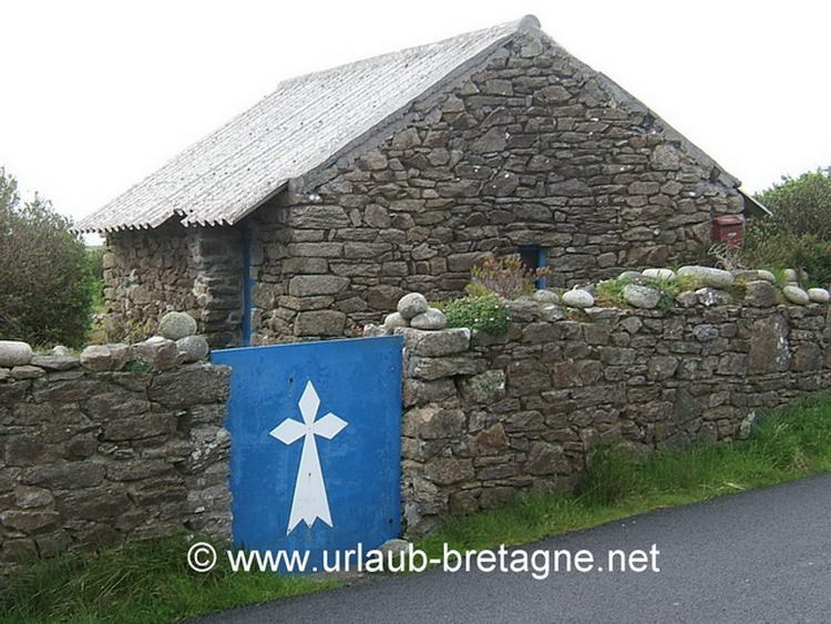
Two typical houses dating back to the 18th and 19th centuries serve as a museum, and are furnished to demonstrate the austere and meagre way of life of that time. The furniture was made of multicoloured wood originating from various shipwrecks. The grain which was harvested and milled by the women was stored in chests under the bed. Heating was provided by means dried cow dung and seaweed.
Today, Ouessant has a population of 1000, and in addition has 1000 sheep, 500 cars, a private catholic school, a doctor and a police station which is only manned during the tourist season.
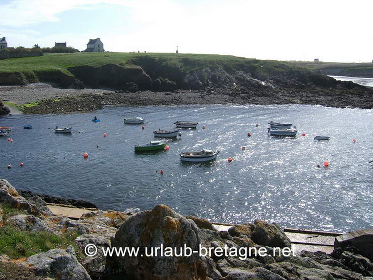
The touristic infrastructure and facilities are quite modes. The island boasts only a couple of small hotels, a few bed and breakfasts, a tiny campsite, a couple of crêperies and restaurants, a diving school, a yachting club and a small horse farm. There are only five professional fishermen left on Ouessant. Sheep farming is stiil pursued, mainly for means of self-sufficiency.
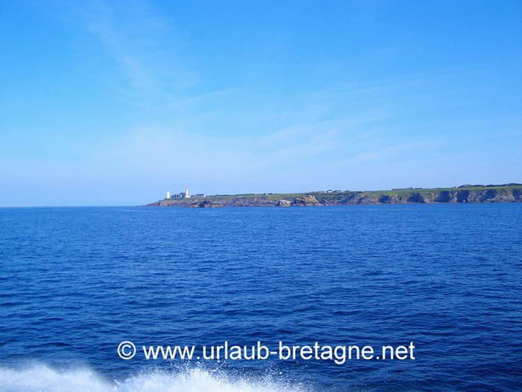
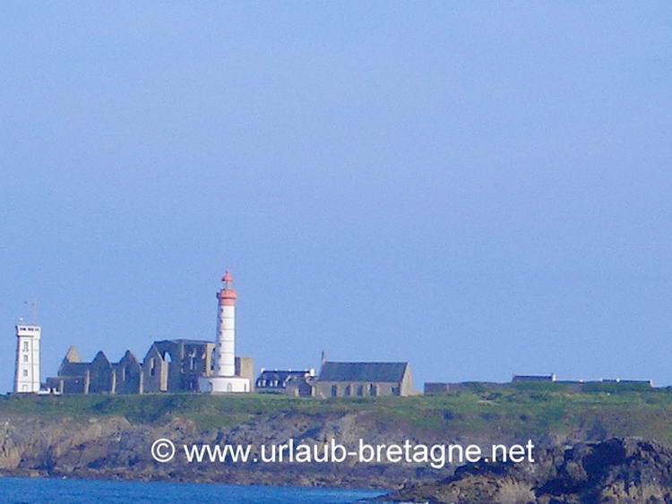
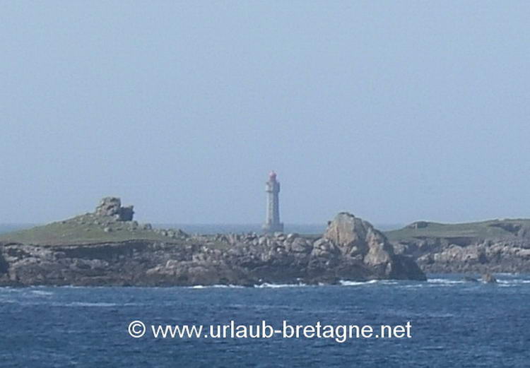
A museum located at the foot of the impressive 55 metre black and white lighthouse: Phare du Créac’h provides informative facts about the local history of the numerous lighthouses, signalling apparatus, beacons and buoys In the meantime, the Phare du Créac’h, constructed in 1862, is the most powerful lighthouse in Europe and is fully automated. Its light beam is visible up to 50 kilometres out to sea.
At night a myriad of flashing white, red and green navigation lights can be observed ou to sea The beacons of Kéréon, La Jument, Men grain and Nividig illuminate the reef-enclosed channel entrance.
Ile de Sein
This Breton Island is situated approximately 8 km from the famous Pointe du Raz. It has a total surface area of only 60 hectares, with its highest point being only 9 metres above mean sea level.
The island seems to be an entity of its own, where time has lost its meaning. Since prehistoric times, people have lived here seemingly isolated from the world, coexisting in the rugged environment, surrounded by cliffs and the sometimes rebelliously untamed Atlantic. She was the last refuge of the Druids in Brittany.
The island is situated at the entrance to the “Manche” (English Channel), one of the world’s busiest and most important shippng lanes. Her people have always been known as “rescuers of the shipwrecked”. Thanks to the lighthouses of Sein and Ar, seafarers are able to navigate safely through the treacherous waters.
In contrast to the harsh environment, the people of the island demonstrate, by their nature, great generosity and solidarity. In 1796, 700 shipwreck victims were taken in, sheltered and cared for.
Impressively courageous were the 150 men who, in 1940, followed the famous appeal of General de Gaulle, and took to sea with their ships in order to join the forces of the “Free French”. They alone constituted a quarter of the entire French naval forces. At the end of World War II, as one of only five , Ile de Sein received the award: "Compagnon de la Liberation” from General de Gaulle.
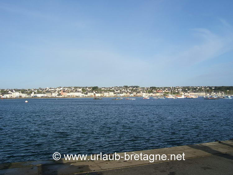
Arriving at one of the island’s two small ports on the "Quaides Paimpolais" ferry, there are a few restaurants and supermarket awaiting visitors on the habour promenade. A walk through the village is worthwhile. For protection against the win, the houses were built in very close proximity to each other. The narrow streets are adorned with beautiful flowers and shrubs, providing a wonderful scene in the afternoon sunlight.
At the "Quai des Francais Libre", the island’s actual fishing port, the few cafes are already frequented by locals in the early morning. The 2 km long and 40 to 800 m wide island has a good footpath and be can be circumnavigated relatively quickly. The trail begins in the village on the “Quai des Paimpolais”, just past the Eglise Saint-Guénolé. The light house can be reached over the flat and somewhat barren terrain. If visibility is good, one can see the "Ar-Men" lighthouse located in front of the island to the west. The highest point of the island is only 1.5 metres above sea level.
The island and its surrounding area is under protection, largely due to its highly significant population of nesting seabirds.
More Information:
Ferry services to Ouessant, lle de Sein and lle de Molene operate from the ports of Audierne, Brest, Le Conquet and Camaret. On route there are numerous lighthouses to be seen.
Ile Molène
The archipelago of Molène consists of a main island, only 1 km long, 900m wide and 26m high, together with a chain of small islets. Molène has a natural harbour that has enabled the islanders to fish for their main subsistance. In future it may be the nature conservation and and plant protection that provides the main source of income for the islanders, as the archipelago has been declared a UNESCO oceanic biosphere reserve. The larger main island is the only one of the group which is inhabited, with less than 300 people living there throughout the year. Most leave the island in autumn, and the few who remain for the winter receive their supplies by the mail boat.
The island is entirely car-free; vehicles are deemed unnecessary here, as it is possible to cross the island on foot in less than an hour. The island is considered a true little paradise, eventhough there are absolutely no trees. This fact earned her the nickname "The Barren Isle". It is, however, the extraordinary variety of wildlife that makes the island well worth seeing, and the tranquil setting in which a multitude of marine mammals and many species of birds can be observed. One gets the impression that time has stood still. Incidentally, the islanders lived in harmony with the rhythm of the sun until 1976! There are still some stubborn individuals who vehemently oppose the “new ways” and hang on to the old traditions, come what may! The islands are surrounded by channels and treacherously strong currents that make navigation particularly hazardous. For example the “Fromveur "(big torrent) is very deep example, where the current reaches a massive 16 kmh, the fastet in Europe.
A museum on Molène illustrates the shipwreck of the British passenger ship "Drummond Castle "off the coast of the island in 1896. As a token of appreciation and thanks for the bravery and devotion of the rescuers, Queen Victoria donated a rain water collection cistern to the island’s inhabitants.
The island is served regularely by ferries from Brest, Camaret-sur-Mer and Le Conquet.